Thinking about daily life in Sage Creek but not sure what it actually feels like beyond the listing photos? You want a place that makes your commute manageable, offers easy access to parks and trails, and simplifies errands. This guide walks you through a typical day so you can picture the rhythm, along with clear steps to verify the details that matter most. Let’s dive in.
Where Sage Creek fits
“Sage Creek” appears in several newer residential areas across Northern Colorado, including the Fort Collins area and parts of the Denver metro. That means the exact experience can vary by street and city limits. Before you compare commute times or schools, start by confirming your address’s jurisdiction and county.
- Use the City of Fort Collins website to check property and service details if your address falls inside city limits. Visit the main site and follow the property search tools on the city pages at the City of Fort Collins website.
- If the home is in unincorporated county or a nearby town, confirm parcel info and taxes through the Larimer County assessor and GIS or the appropriate county if different.
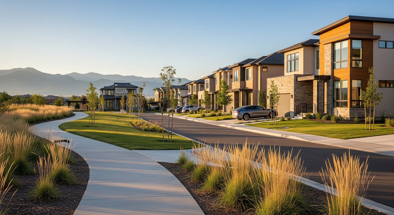
Newer subdivisions in the Fort Collins area typically feature sidewalks, small pocket parks or open space, and a mix of single-family homes and townhomes. HOAs commonly manage landscaping in shared areas and set neighborhood standards. If you’re evaluating a specific home, review HOA documents for fees and rules.
Commute options and timing
Daily commute patterns vary by your exact location and schedule. The region’s main corridors include I-25 for north–south travel, US-287 through Fort Collins, and key arterials like Harmony Road and College Avenue.
Driving to Fort Collins and Denver
- To downtown Fort Collins or CSU, you can often expect a roughly 10 to 25 minute drive depending on where you start and peak-hour traffic.
- To Denver, many commuters plan for about 60 to 90 minutes by car in typical conditions, with longer times during storms or construction.
Always verify realistic travel times for your exact schedule using a live map app at the same hours you plan to travel. Conditions change with weather and road work.
Transit and biking options
- Local bus: Fort Collins’ Transfort system runs local routes and the MAX Bus Rapid Transit along the Mason Corridor serving CSU and downtown. Check routes and schedules on Transfort’s website to see if a stop is near your address.
- Regional coach: For trips toward Denver, the state’s Bustang service offers intercity options. Review schedules and stops at Bustang.
- Bike access: Fort Collins is known for bike-friendly planning with on-street lanes and paved multi-use trails connecting many neighborhoods to schools, parks, and shopping. A lot of daily errands become short rides when you are near the trail network.
Parks, trails, and time outside
Outdoor access is a highlight of living near Fort Collins. Even smaller subdivisions usually plug into a bigger web of trails and open spaces.
Trails you can tap into
- Poudre River Trail: This major multi-use pathway links neighborhoods to the river corridor and Old Town. It’s popular for running, biking, and weekend walks.
- Spring Creek Trail and connectors: These paved paths help you move across town without relying on the car for every errand. To explore official trail maps and park locations, use the Fort Collins Parks & Natural Areas map.
Weekend escapes nearby
- Horsetooth Reservoir and Lory State Park sit west of town and offer hiking, mountain biking, boating, and big views. Check conditions and recreation info with Colorado Parks & Wildlife.
- If you want a quick list of things to do, eateries, and events across the city, browse Visit Fort Collins for inspiration.
In winter, many trails remain usable, but expect snow and ice at times. Trail plowing priorities vary by corridor, so plan footwear and timing accordingly.
Groceries, coffee, and care
Day-to-day errands are straightforward. Common grocery options in the region include King Soopers, Safeway, Sprouts, and Natural Grocers, plus independent shops in Old Town. Local coffee spots and casual dining are easy to find along main arterials and in downtown areas.
For healthcare, major providers serving the Fort Collins–Loveland corridor include UCHealth facilities such as Poudre Valley Hospital and the Medical Center of the Rockies in Loveland. Urgent care and primary care clinics are spread across the area, so your closest choice will depend on your exact address.
What school options look like
School assignments depend on jurisdiction and district boundaries. Many Fort Collins addresses fall within Poudre School District. Because similarly named neighborhoods exist in different communities, verify by address rather than name.
- Use the district’s boundary and school lookup tools on the Poudre School District website.
- If your address is outside Fort Collins, check the appropriate district’s site for boundary maps and enrollment details.
Keep your language neutral as you compare schools and focus on fit for your learner’s needs. District sites typically provide performance reports and program descriptions.
Seasonal living tips
Northern Colorado’s four seasons add variety to daily life. Winters bring cold snaps and snow, which can affect drive times and trail conditions. Spring runoff can raise river levels around the Poudre. Summers are warm and sunny, great for early morning or evening trail time. A flexible routine helps you keep your commute and outdoor plans on track year-round.
Quick checklist before you decide
- Verify the exact city or town for your address on the City of Fort Collins website or with the Larimer County assessor if applicable.
- Price out commute options at your actual travel times using a live map app.
- Confirm nearby bus routes on Transfort and regional options on Bustang.
- Map the closest parks, playgrounds, and trail connections using the Parks & Natural Areas map.
- Check school boundaries through the Poudre School District if your address is in PSD.
- Review HOA documents for fees, amenities, and property standards.
If you’re weighing a move to Sage Creek or a similar North Denver suburb, you do not have to figure it out alone. Reach out to Jackie Roacho for local guidance, on-the-ground verification, and a plan tailored to your timeline. Schedule a free consultation.
FAQs
How long is the commute from Sage Creek to downtown Fort Collins?
- Depending on exact location and peak traffic, many residents plan for roughly 10 to 25 minutes by car; confirm with a live map at your typical travel time.
What public transit options serve Sage Creek in the Fort Collins area?
- Transfort runs local routes and the MAX BRT; check stop locations and schedules on the Transfort site for your address.
Are there regional buses from Fort Collins toward Denver?
- Yes, the state’s Bustang service offers intercity coach options; see routes and times at Bustang.
What parks and trails are near Sage Creek in Fort Collins?
- Many neighborhoods connect to paved multi-use paths like the Poudre River Trail and Spring Creek Trail; see the Parks & Natural Areas map.
Which schools serve Sage Creek addresses in Fort Collins?
- Assignments vary by address; confirm boundaries and enrollment info on the Poudre School District website.
Where can I find official neighborhood safety and policing information?
- Review data and resources from Fort Collins Police Services on the city’s police page.
Is Sage Creek typically part of an HOA?
- Many newer subdivisions use HOAs for shared-area maintenance and standards; review the specific HOA documents for fees and rules.